The SeismoScan Project
Project Overview
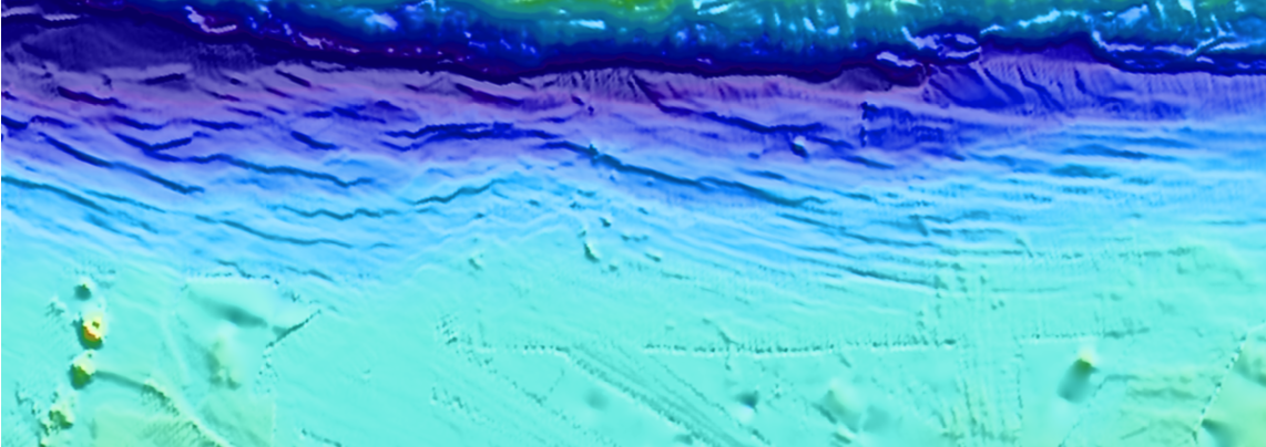
SeismoScan is a senior capstone project focused on creating an automated system for identifying submarine faults within bathymetry data. Geological researchers currently rely on manual mapping methods, which require scanning large seafloor regions and hand-tracing possible fault structures. This process is accurate but extremely time-intensive.
The goal of SeismoScan was to reduce the time needed for fault identification by developing a machine learning–based tool capable of automatically highlighting regions in bathymetry data that show characteristics similar to known fault structures.
The Problem
Submarine faults play a vital role in understanding earthquakes, tsunamis, and tectonic movement. However, identifying these faults requires analyzing high-resolution bathymetry datasets that can span tens of thousands of square kilometers.
As more marine surveys produce increasingly detailed depth maps, the amount of data exceeds what can be realistically examined by hand. Without automated tools, researchers face long turnaround times before results can be used for scientific studies or hazard assessments.
Why It Matters
Fault mapping is essential for understanding the evolution of the ocean floor and its relationship to large-scale Earth processes. Automated tools like SeismoScan can help:
- Reduce manual labor for geologists
- Identify fault structures more consistently
- Enable quicker analysis of new datasets
- Support research on seismic hazards and plate boundaries
How SeismoScan Works
The project centers on developing a hybrid machine learning workflow designed to automatically identify patterns in bathymetry grids. These patterns often present as linear breaks, changes in slope, or abrupt depth transitions that may indicate faulting.
Our approach focuses on three major components:
- Spatial Feature Detection: Using machine learning techniques to analyze depth variations and identify patterns commonly associated with fault structures.
- Grouping & Structure Analysis: Clustering methods help group related detections into continuous features rather than isolated points.
- Classification & Interpretation: Additional analysis helps determine which detected structures are most likely to represent actual faults.
The final output of the system provides users with a set of coordinates or segments that represent regions of interest for geological interpretation.
Project Goals
- Automate the identification of potential submarine faults
- Process bathymetry datasets efficiently and consistently
- Reduce the manual effort required for fault mapping
- Create a workflow accessible to both geologists and computational users
- Produce meaningful outputs useful for research and analysis