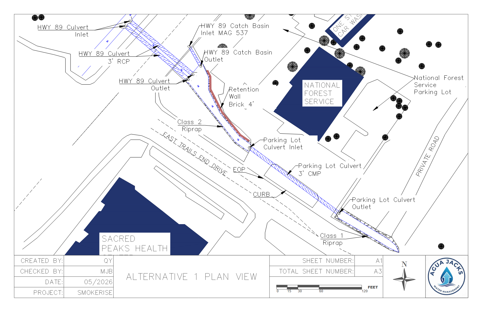
Alternative 1 looks to maximize flow conveyance through structural and grading improvements. The channel/basin area adjacent to the National Park Service will be regraded into a trapezoidal shape to better convey water through this area. The culvert running under the National Park Service parking lot will remain as existing, but cleared of large debris and sediment. The gravel, valley ditch will be removed and replaced with a defined flow path as an open channel. Riprap would be added for the entirety of the channel to protect erosion and lower flow velocities. Class 2 riprap will be added to the upstream section of the channel, Class 1 riprap will be added to the channel downstream of the parking lot culvert.
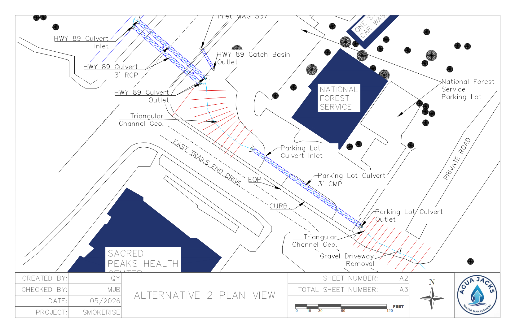
Alternative 2 focused on creating a design that would best fit predicted flow paths for long-term stability. Items that were improved include a revised channel geometry, alignment, and grading. Mostly triangular channel geometry would be utilized. No culverts improvements would be made except for typical maintenance. The gravel road/valley ditch would be removed to allow an open channel to be constructed.
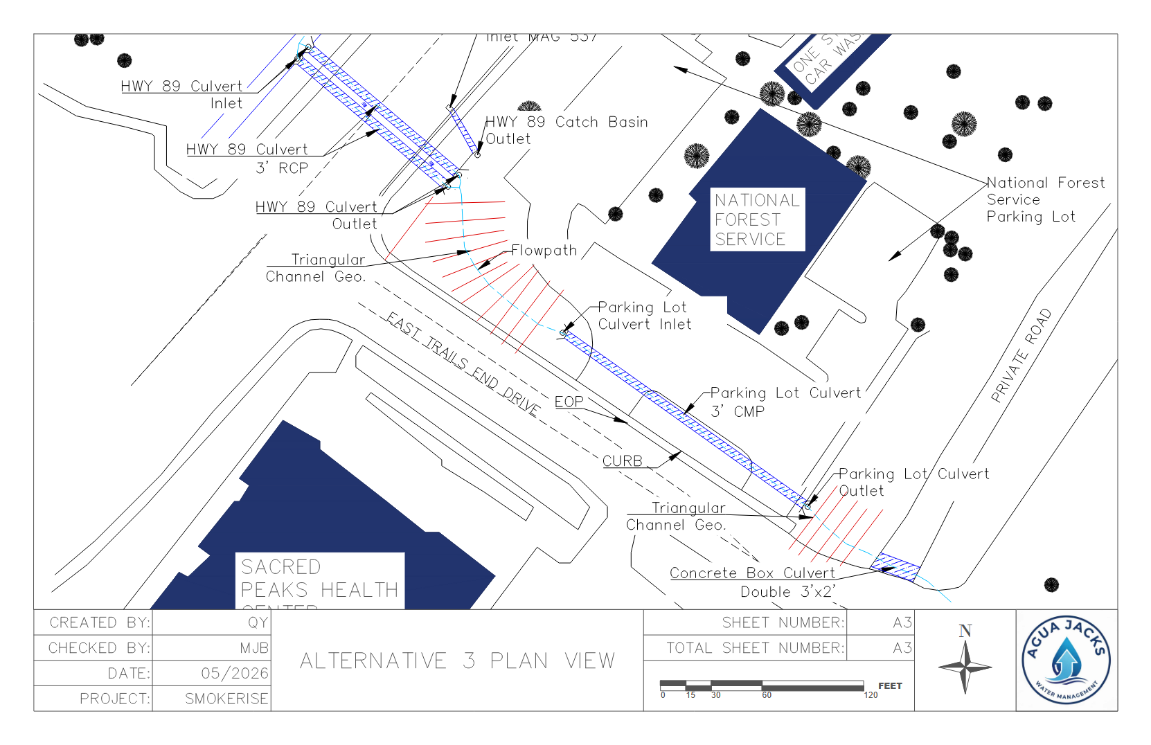
Alternative 3 would have an emphasis on using new stormwater infrastructure to convey flow through the downstream of the channel. Trapezoidal geometry would be utilized similarly in Alternative 1, however a double-barrel culvert would be added under the gravel road/valley ditch. This double barrel culvert would be sized to 3 feet of span and 2 feet of height. This would allow the gravel road driveway entrance to still be utilized, but at high economic cost.